Transforming Industries
From Lagos to Abuja, from Benin City to Port Harcourt, AERO AI empowers key industries with cutting-edge geospatial intelligence for sustainable growth and development.
Discuss Your Industry NeedsIndustries We Serve
Specialized geospatial solutions tailored for key dynamic sectors
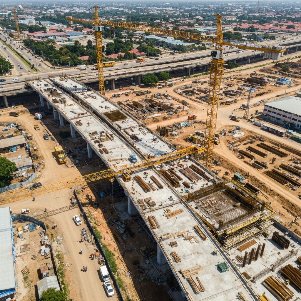
Monitor major infrastructure projects including flyovers, bridges, and urban developments. Real-time progress tracking with millimeter accuracy for government and private contractors.
- • Construction progress monitoring
- • Quality control and compliance
- • 3D modeling and digital twins
- • Stakeholder reporting and transparency

Transform agriculture with precision farming techniques. From land suitability analysis to crop monitoring, optimize yields and resource management for sustainable farming.
- • Land suitability assessment
- • Crop health monitoring (NDVI)
- • Irrigation optimization
- • Yield forecasting and planning
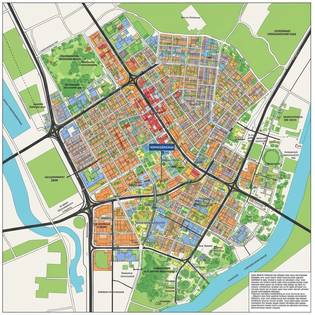
Support rapid urbanization with intelligent planning tools. Analyze population density, infrastructure needs, and environmental impacts for sustainable city development.
- • Urban density analysis
- • Infrastructure planning
- • Environmental impact assessment
- • Traffic and transportation planning
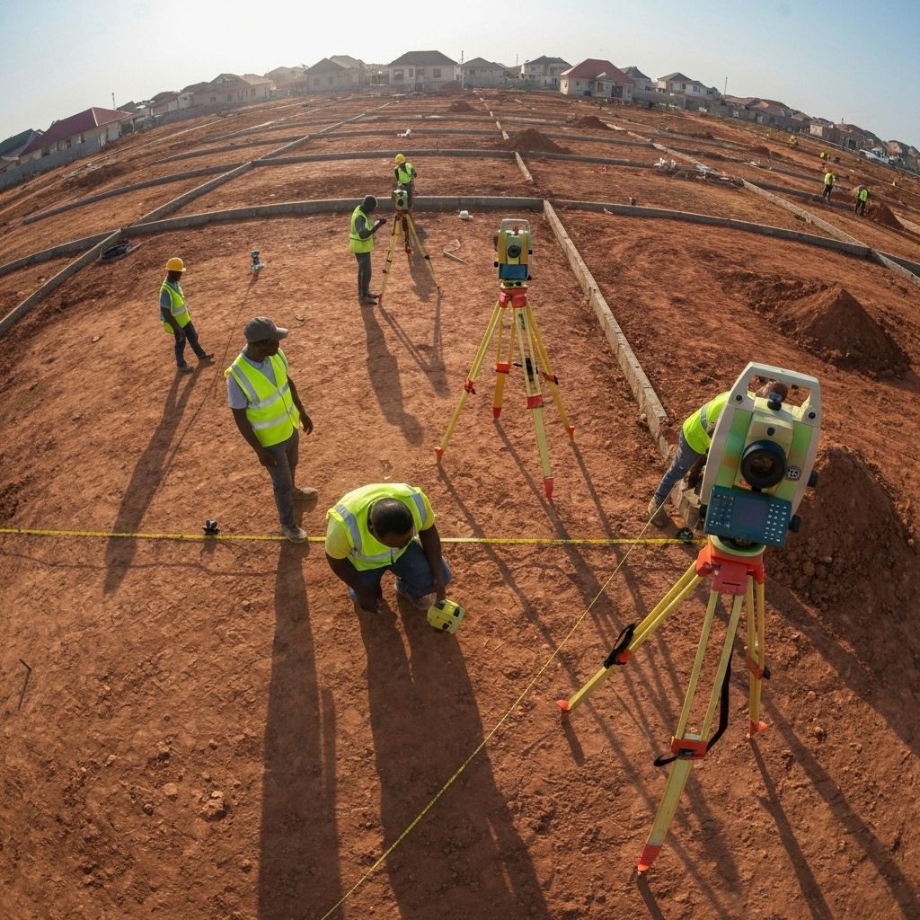
Streamline land administration and real estate development with SURCON-registered surveying services. Support Certificate of Occupancy applications with accurate, up-to-date geospatial data.
- • SURCON-registered surveying
- • Certificate of Occupancy support
- • Property boundary mapping
- • Land dispute resolution

Partner with government agencies for transparent, data-driven decision making. Monitor public infrastructure, urban development, and environmental changes across states.
- • Public infrastructure monitoring
- • Transparent project reporting
- • Environmental monitoring
- • Disaster response and planning

Support the energy sector with precise monitoring of power infrastructure, renewable energy projects, and utility networks. Optimize maintenance and expansion planning.
- • Power line inspection and monitoring
- • Solar farm site assessment
- • Pipeline monitoring and maintenance
- • Grid expansion planning
Why Industries Choose AERO AI GEOSPATIAL TECHNOLOGIES
Local expertise, international standards, and cutting-edge technology for unique challenges
Local Expertise
Based in Benin City with deep understanding of terrain, regulations, and market needs.
Rapid Deployment
Quick project turnaround with state-of-the-art drones and processing capabilities.
SURCON Compliance
SURCON-registered surveyors ensuring all deliverables meet professional standards.
Innovation Focus
Cutting-edge AI and geospatial technology adapted for unique development challenges.
Ready to Transform Your Industry?
Join leading organizations already using AERO AI geospatial intelligence for competitive advantage