Real Impact Stories
Discover how AERO AI Geospatial Technologies is transforming projects, from major infrastructure developments to precision agriculture initiatives.
Start Your Success StoryFlyover Construction Monitoring: A Story of Digital Transformation
When the Edo State government partnered with CCECC to build a critical flyover in Benin City, they needed more than traditional project management. They needed real-time, transparent monitoring that could ensure quality, track progress, and provide accountability to stakeholders.
Proactive Quality Control
Millimeter-accurate monitoring identified potential issues before they became costly problems
Transparent Progress Tracking
Visual timeline of development accessible to all stakeholders and the public
Data-Driven Decisions
Project managers received precise data to stay on time and budget
Live Construction Monitoring
Updated weekly with drone imagery
More Success Stories
Real projects, real results, real impact across industries
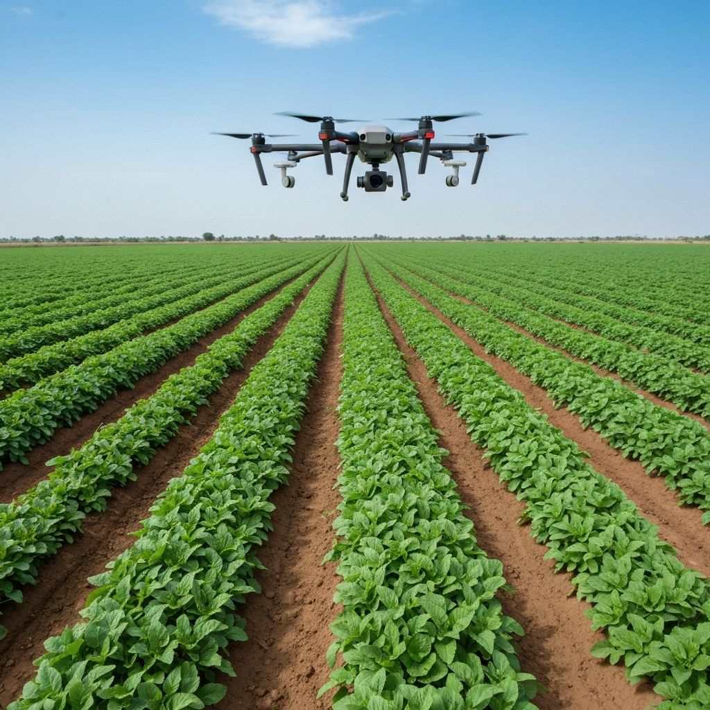
A proposed farm site transformation from traditional guesswork to data-driven precision agriculture. Our comprehensive analysis helped the client optimize land use, reduce costs, and increase projected yields.
- • Soil and topography mapping
- • Irrigation optimization planning
- • Crop suitability analysis
- • Fertilizer application zones
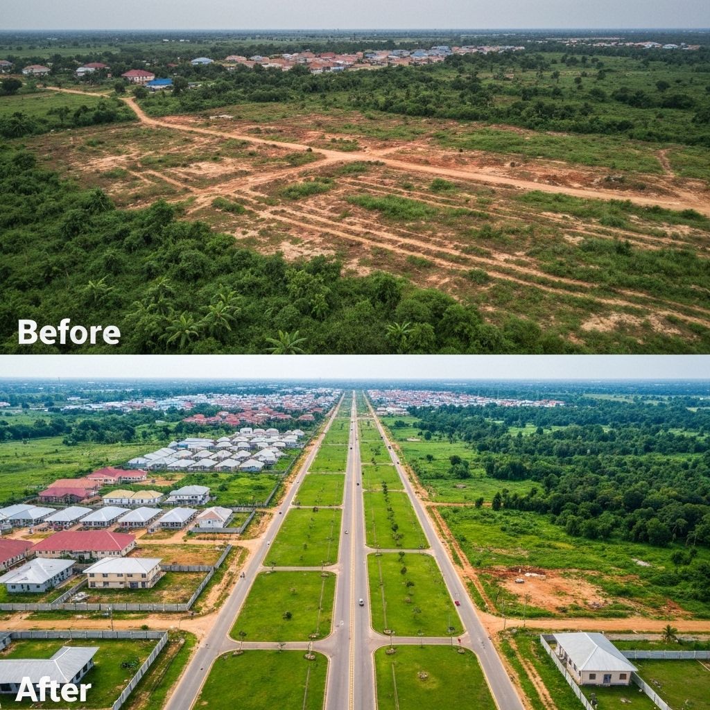
A client was shown two-year-old satellite imagery that failed to reflect recent development, causing doubt about progress. Our drone flight provided current, high-resolution imagery that restored confidence and validated the survey.
- • Real-time vs outdated imagery comparison
- • High-resolution drone mapping
- • Survey validation and documentation
- • Client confidence restoration

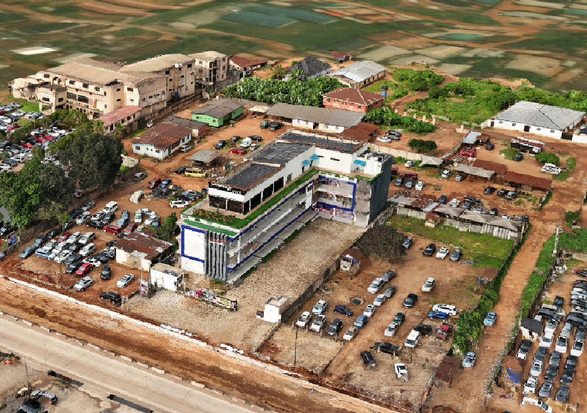
We applied our own technology to our office location, demonstrating the quality and precision we bring to every client project. This serves as a live showcase of our capabilities.
- • High-resolution 2D imagery
- • 3D model and digital twin creation
- • Asset management base layer
- • Quality demonstration for clients
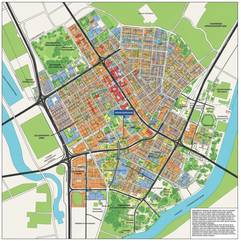
Comprehensive mapping of Benin City's buildings and waterways provides foundational data for urban intelligence, enabling better planning, flood risk management, and sustainable development.
- • Building footprint extraction
- • Waterway mapping and analysis
- • Population density estimation
- • Flood risk assessment
Our Impact
Measurable results that drive development forward
Ready to Create Your Success Story?
Join the growing list of organizations transforming their operations with AERO AI geospatial intelligence